 |
Clubhouse and Ingleside Racetrack, 1912 <> 2012 |  |

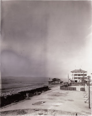
The Ingleside Track Clubhouse was at the southeast corner of Cerritos and Moncada, as a 1915 map illustrates. The carriage entrance was on Cerritos and the south side of the clubhouse was adjacent to the racetrack. On the right in the picture above are the remnants of the grandstands and the stables, which became the workshop for the Urban Realty Improvement Company. |
 |

Clubhouse and outer track. The later photo below shows a house on the outside of Urbano drive on the path of the outer track. The houses in the background of these pictures are on the north side of Cerritos. |
 |

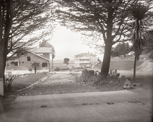
The pictures above and below show the clubhouse behind the house on Urbano. |
 |
These views from the east cannot be duplicated now, as there are many trees and houses in the way. The fence is part of the tennis court. The building under construction is on the south side of Cerritos Ave. |
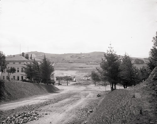 
The view looking south on Moncada Way has Merced Heights in the background. The view looking north across the former racetrack shows Mt. Davidson. |
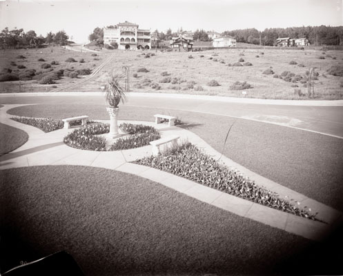 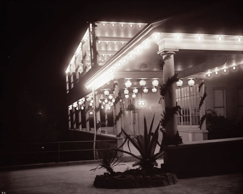
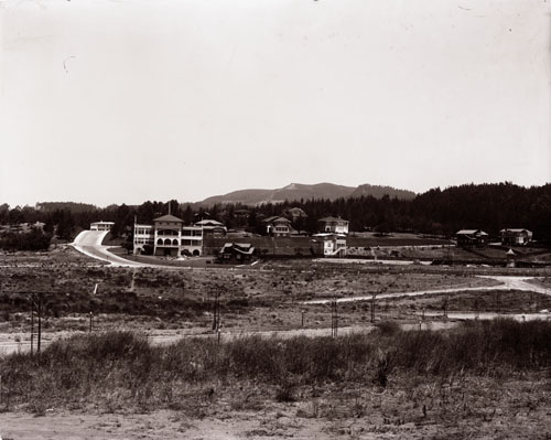
View looking northeast from the Sundial. The Clubhouse at night. |
 |  |
| In the 1910's and 20's, URICo (the Urban Realty Improvement Company) used the racetrack clubhouse, then also called the Ingleside Terraces Clubhouse, 85 Cerritos Avenue, as a sales office.
85 Cerritos Av was also the address for the Urico Painting Co, the Urico Mill & Lumber Co, and the Urico Plumbing Co. Note the similarity between "Urico" and the California state motto, "Eureka", "I have found it". The Ingleside Terraces Improvement Club met at the Club House, 85 Cerritos Av, in the 1920's. In the 1930's, the sales office was no longer needed as most of the contruction in Ingleside Terraces was completed. The Clubhouse was replaced by a home at 95 Cerritos in 1938 and the double lot was divided to make room for a home at 85 Cerritos in the early 1950's. 1915 and 1950 maps The Ingleside Terraces Homes Association Board of Directors met in "Scout Hall" in the basement of 21 Urbano in the early 1940's (SFChronicle archives from the SFPL). | |

1911 Chevalier Map showing the Ingleside Racetrack Ingleside Terraces History |

Current Ingleside Terraces map. |
| Length of Ingleside Racetrack and Urbano Drive | |
Urbano Drive lies on the path of the old Ingleside Racetrack. Many people have noticed that the length of Urbano Drive, according to an automobile or bicycle odometer, is less than one mile. GPS and Google maps measurements confirmed that the length of the center of Urbano Drive is 0.92 statute miles, also known as the "IT mile"; (inner sidewalk 0.90 miles, outer sidewalk 0.94 miles). According to an article in the San Francisco Chronicle on January 1, 1899 (available at the SFPL), there were two tracks, with the outer being a mile long. With a one mile outer track, inner tracks are usually seven furlongs, 7/8 of a mile, 0.875 miles. Here's how to calculate the length of Urbano Drive on a map. | |
 |  |
| Ingleside track showing the grandstand, the outer track, a terrace, and (photo on right) the outer and inner tracks. Urbano Drive lies over the center of the inner track and the houses along the outside of Urbano Drive lie on the path of the outer track. | |
 |  |
| The 1950 parcel map shows a building, left center, labeled Club House, which was built in 1929. A current picture of this building is on the right. According to Woody LaBounty, this was originally an American Legion clubhouse, hence the name Legion Court. The building in the background on Ashton Ave. was originally a Masonic Hall. | |
