|
|
< < < < < < < < < < < <
Forest Hill to West Portal
stairs
114 Muni Metro station
135 Pacheco
307 Castenada to Mendosa
556 total stairs
1.4 miles
400 stairs per mile
400 feet elevation gain,
286 feet per mile
< < < < < < < < < < < <
|
> > > > > > > > > > > >
Forest Hill to
Golden Gate Heights
stairs
Pacheco 135
Castenada to Mendosa 307
Oriole 98
Quintara 135
Mandalay(Pacheco) 165
Total stairs 840
Miles 2.1
Stairs per mile 400
Elevation gain 600 feet,
286 feet per mile
|
> > > > > > > > > > > >
Forest Hill 8
stairs
Pacheco 135
Castenada to Mendosa 307
Ventura to 8th 49
Ventura to Alton 26
Pacheco to Sotelo 102
Forest Hill Path 73
Total stairs 620
Miles 1.6
Stairs per mile 388
Elevation gain 430 feet,
270 feet per mile
> > > > > > > > > > > >
|
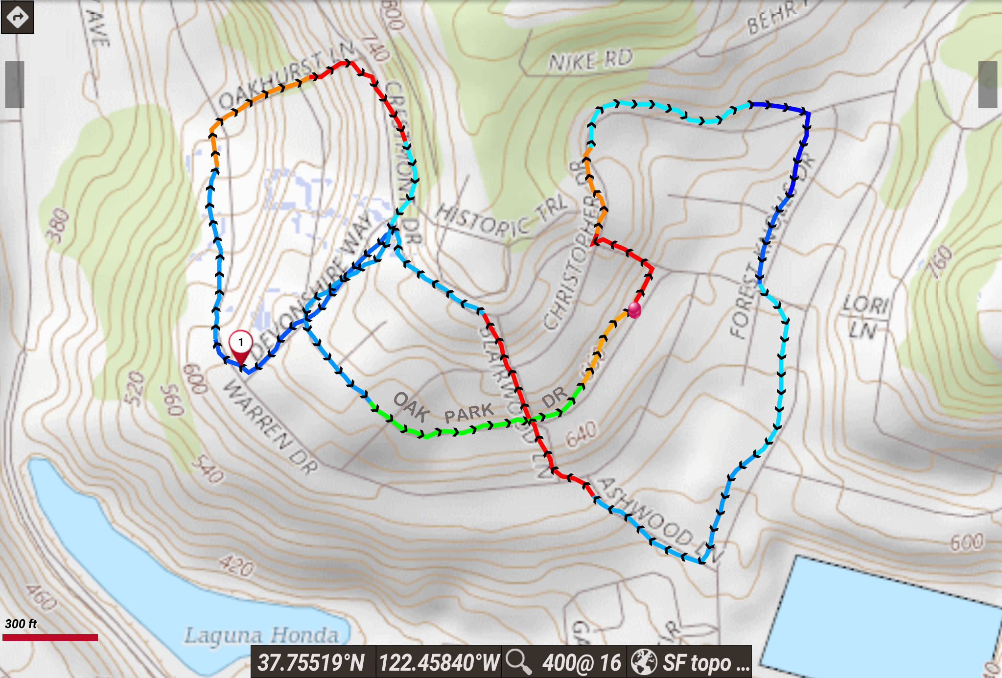
red>orange: uphill
blue: downhill
|
|
|


